super/collider takes us to the tip of Australia, where spectacular, tubular clouds fill the morning skies
Where on Earth?
Gulf of Carpentaria, Australia
GPS Coordinates: 17°43′S 139°0″E
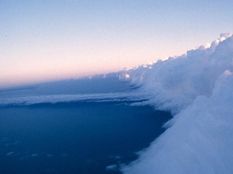
As springtime reaches the southern hemisphere, glider pilots from around the world begin to gather in the dusty outpost of Burketown in northern Australia – population 173. The town’s only pub is a stereotypical Australian classic promising ice cold beer amid the rising heat, but that’s not what draws them. Out over the Gulf of Carpentaria, atmospheric conditions begin conspiring to create some of the most spectacular cloud formations on Earth. Starting around September, waves of spectacular rolling clouds begin to form in the region’s skies – a phenomenon known since ancient times as kangólgi to the local Aboriginal people and more recently as 'Morning Glory' clouds because they always appear at dawn.
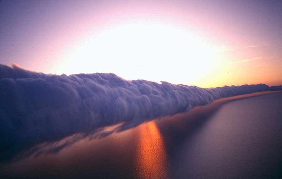
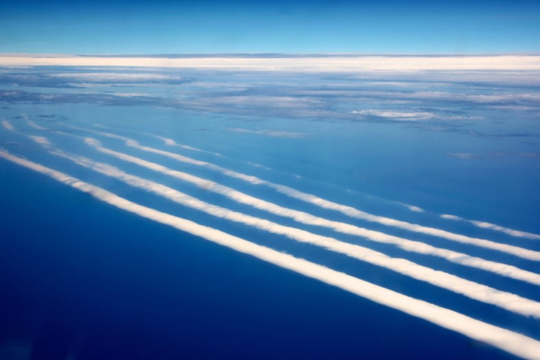
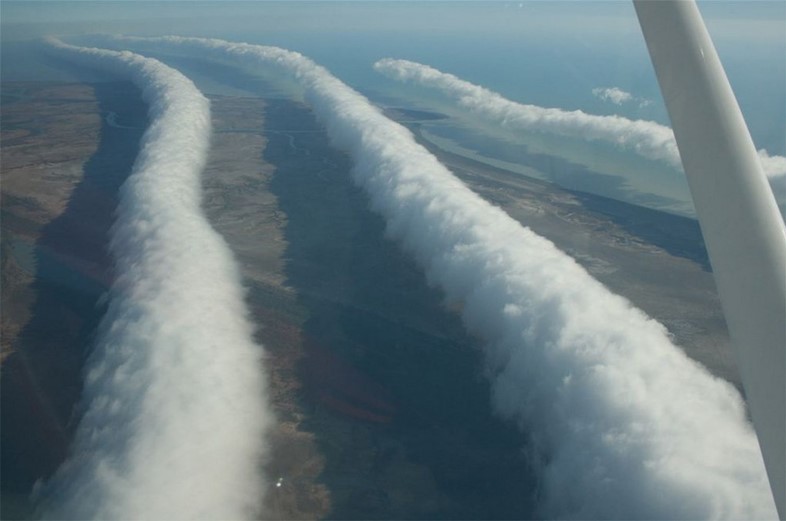
Up to a thousand kilometres long and two kilometres high, these incredible tube-like clouds do form in other parts of the world, but not as regularly and predictably as in this part of Australia. As peak-season sets in, powered gliders cruise up to meet the incoming morning clouds before turning off their engines and floating along and over their edges. Surfing along these seemingly infinite white lines, they can travel over 500 miles before landing – and there’s the sheer beauty of riding along what one pilot has described as a 'highway in the sky'.
 clouds)
What on Earth?
Roll clouds are a fairly rare type of arcus cloud – low-lying horizontal formations that can accompany thunderstorms or form from sea breezes. As their name implies, the clouds ‘roll’ along a central axis. They can develop on their own, but more frequently occur in successive waves of up to ten, strung out like rope lines across the landscape. Each cloud is just the visible part of a atmospheric wave rolling across the sky at up to 60km/h. Eerily, as the clouds pass overhead, conditions on the ground reportedly become calm and quiet, with the wind dying down completely as the vast formations pass just 100-200m overhead. How exactly these waves form still isn’t entirely clear, and it probably varies by location.
In northern Australia, it’s likely that the unique combination of land and sea is responsible for the regular appearance of the Morning Glory phenomenon. Breezes hitting both sides of the Cape York peninsula on the east side of the Gulf first create a line of cloud. As the cold night air descends, it hits a warm inversion layer over the water and ducks beneath it, creating the rolling pattern. Moist air in the morning forms the clouds, which last until the day heats up and the inversion layer disappears. This matches observations in Burketown, where local lore has it that the corners of the old tables in the pub turn up in the humidity when conditions are just right.

How on Earth?
Burketown has long been on the bucket list of glider pilots, but the town is now capitalising on wider interest in its unique weather with an annual Morning Glory Festival with bands, local tours and a craft fair. The first one was this year in late September and peak gliding season is October. For more, head here.